
In the heart of northern Israel, an ancient basalt stone has emerged from the earth, carrying the weight of nearly 1,700 years of history. Inscribed with the names of Roman emperors and forgotten villages, this boundary marker unveils a fascinating tale of land ownership, taxation, and life under the Roman Empire. Its discovery is more than just an archaeological find—it’s a tangible link to a world where governance and daily survival intertwined, revealing stories long buried in time.
Unearthing an Ancient Landmark
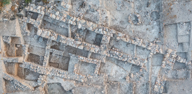
The excavation at Abel Beth Maacah, led by researchers from the Hebrew University and Azusa Pacific University, brought to light this remarkable boundary stone during their 2022 field season. Measuring over a meter in length and weighing several hundred kilograms, the basalt slab bore Greek inscriptions detailing the names of Roman emperors Diocletian, Maximian, Constantius, and Galerius. Originally marking the borders of agricultural fields, the stone was later repurposed as a grave cover during the Mamluk period. Despite being reused, its inscription provides invaluable insights into the hierarchical governance of the Roman Tetrarchy, established in 293 CE.
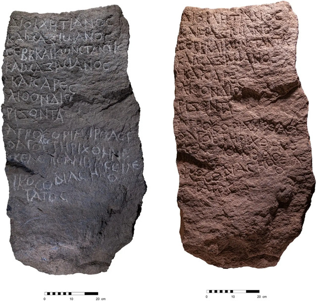
One of the most intriguing aspects of the stone is the mention of an imperial surveyor, Baseilikos, a previously unknown figure who likely played a pivotal role in executing Diocletian’s tax reforms. These reforms aimed to streamline land ownership and taxation, fundamentally shaping the socio-economic landscape of the Roman Near East.
Video
Archaeologists have discovered a rare boundary stone from the Tetrarchy period of the Roman Empire – watch the video to explore the significance of this remarkable find!
Decoding the Inscription: Names and Mysteries
The Greek inscription on the stone is not just a testament to Roman administrative precision but also a source of historical intrigue. It mentions two previously unknown villages, Tirthas and Golgol, which are believed to correspond to modern sites Kh. Turritha and Tell ‘Ajul, respectively. The inclusion of these names provides a rare glimpse into the geographical and social dynamics of the time.
Interestingly, the inscription pairs the terms “fields” and “boundaries,” a linguistic anomaly not commonly found on similar stones. Scholars speculate that this pairing might reflect a blend of Greek and Semitic influences or simply an engraving error corrected on the stone itself. These nuances highlight the challenges and intricacies of documenting land ownership in a multilingual and multicultural empire.
Tirthas and Golgol: Forgotten Villages of the Past
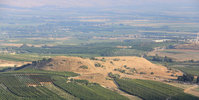
The discovery of Tirthas and Golgol through the boundary stone has opened doors to reconstructing the history of these villages. Archaeological evidence suggests that Tirthas might align with Kh. Turritha, characterized by basalt stone heaps along the Hasbani River. Golgol, derived from the Hebrew root “GLGL” meaning “to roll,” may describe a nearby round hill now called Tell ‘Ajul.
While these villages played a role in the agricultural economy of the region during the Roman period, their absence from Ottoman land tax records indicates they were likely abandoned long before. This pattern mirrors broader regional trends where Roman-era settlements faced decline during the Byzantine and Early Islamic periods. Their disappearance underscores the transient nature of human settlements and the broader socio-political shifts that shaped the Levant.
Roman Tax Reforms and Boundary Stones
The boundary stone is emblematic of Diocletian’s tax reforms, which restructured the Roman taxation system to focus on rural landowners rather than urban centers. By marking field boundaries, stones like this facilitated direct taxation, reflecting the economic independence of rural communities. This shift not only optimized imperial revenue collection but also illustrated the intricate balance between central authority and local livelihoods.
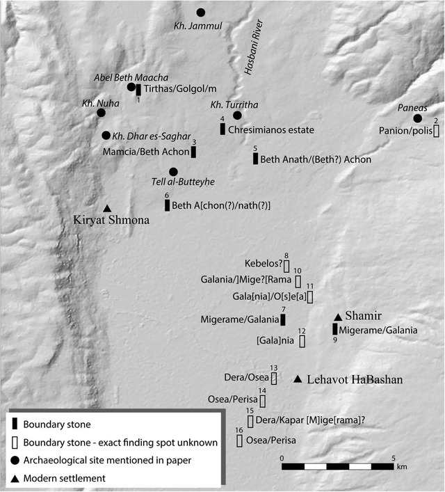
Boundary stones were more than administrative tools; they were symbols of Roman governance and engineering prowess. The discovery of over 40 similar stones in the Hula Valley and neighboring areas highlights the region’s agricultural significance and the empire’s efforts to maintain control over its remote provinces.
The Historical and Biblical Context of Abel Beth Maacah
Abel Beth Maacah, the site of the stone’s discovery, holds a significant place in both archaeological and biblical narratives. Mentioned in the Bible, the site was a focal point of various civilizations, including the Iron Age, Roman, Byzantine, and Ottoman periods. The boundary stone, with its detailed inscription, bridges the gap between these historical layers, connecting imperial Rome to the lives of ordinary people.
Rabbinic sources from the same era reference the burdens of Diocletian’s tax policies, shedding light on the challenges faced by rural communities under imperial rule. The stone’s placement on a hilltop rather than in fields suggests it served as a prominent landmark, reinforcing its symbolic and practical importance.
The Significance of the Discovery
The Abel Beth Maacah boundary stone is more than an artifact; it is a tangible link to the past, offering a window into the lives of those who navigated the complexities of Roman governance. Its inscription reveals the administrative efficiency of the empire and the resilience of local communities adapting to imperial demands. Furthermore, the mention of unknown place names and figures enriches our understanding of the socio-economic and geographic history of the region.
For archaeologists, the discovery underscores the importance of preserving such artifacts. The stone’s reuse during the Mamluk period and its subsequent unearthing highlight the layered history of the site, emphasizing the need for continued research and conservation efforts.
Conclusion
The Roman boundary stone from Abel Beth Maacah is a testament to the empire’s administrative sophistication and the enduring legacy of its governance. Its discovery not only deepens our understanding of land management and taxation during the Roman era but also sheds light on the interconnectedness of history, geography, and human resilience. As archaeologists continue to piece together the stories etched in stone, this artifact serves as a reminder of the intricate tapestry of the past and its lasting impact on the present.