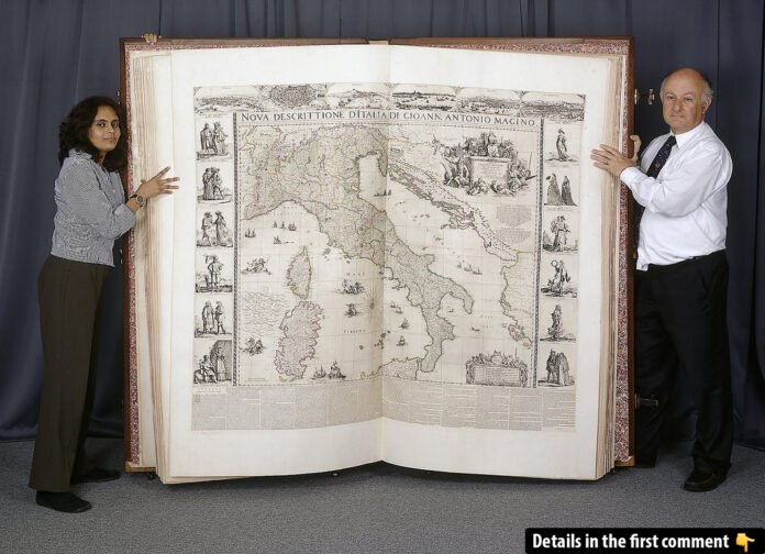
Standing as a remarkable artifact of the 17th century, the Klencke Atlas is a testament to human curiosity and ingenuity. Once the world’s largest atlas, this monumental work not only reflects the geographical knowledge of its time but also serves as a cultural symbol of diplomacy and artistry. With its towering size and historical significance, the Klencke Atlas continues to fascinate historians, cartographers, and the general public alike.
The Creation of the Klencke Atlas
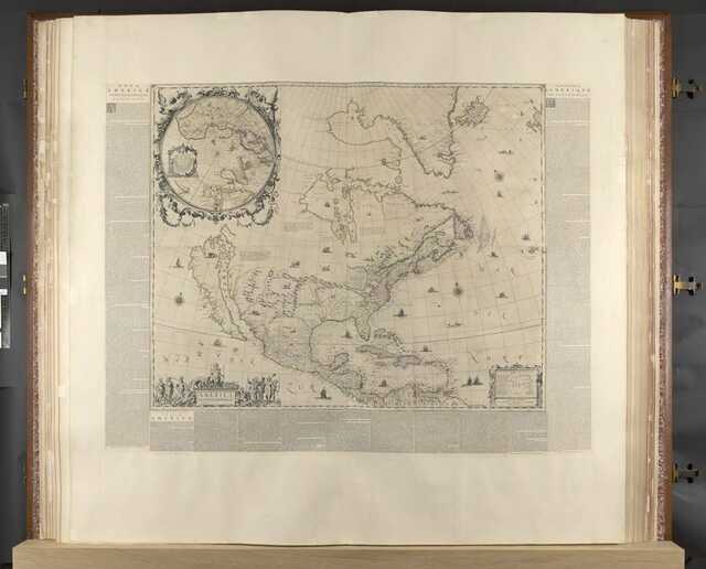
In the heart of The Netherlands during the 1660s, the Klencke Atlas was born as a singular masterpiece, with no copies ever made. Measuring an astounding 1.75 meters (5 feet 9 inches) tall and 1.9 meters (6 feet 3 inches) wide when open, it remains an awe-inspiring object. The atlas consists of 41 copperplate wall maps, meticulously engraved and intended for display, making it a visual repository of all known geographical knowledge of the time.
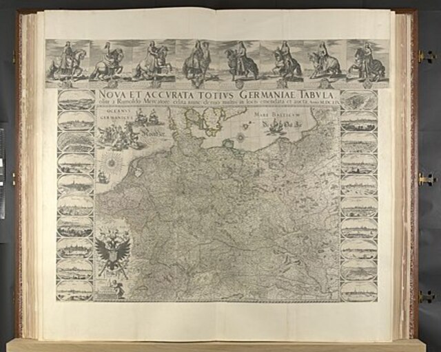
Credited to Dutch Prince John Maurice of Nassau, the atlas brought together the artistry of renowned cartographers and engravers, including Joan Blaeu and Hondius. The maps showcased continents and European states, encapsulating the world as understood in the 17th century. Beyond its geographical purpose, the Klencke Atlas represented a political gesture, crafted to impress and influence.
Video:
Design and Artistic Contributions
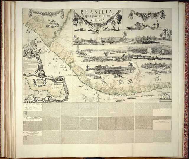
The Klencke Atlas is not just a scientific artifact but also an artistic marvel. Its maps, engraved with precision, reflect the skill of some of the era’s finest artists. The copperplate engravings remain in remarkably good condition, their craftsmanship a tribute to the meticulous work of Joan Blaeu and his contemporaries. The maps were designed to be removed and displayed, making the atlas both functional and decorative.
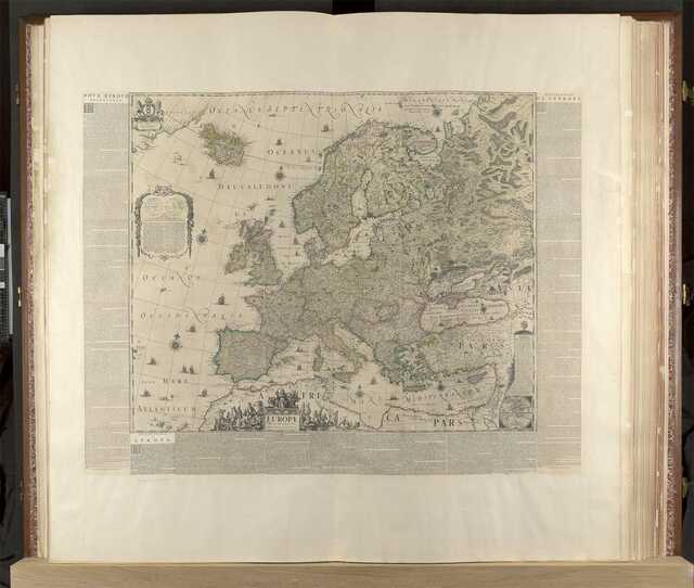
Each map captures the intricate details of continents, countries, and seas, embodying the geographical understanding of the mid-1600s. The quality of these engravings underscores the collaborative effort of art and science, blending aesthetics with information.
Presentation to King Charles II
In 1660, the Klencke Atlas made its way to England as part of a carefully orchestrated diplomatic move. A consortium of Dutch sugar merchants, represented by Johannes Klencke, presented the atlas to King Charles II to commemorate his Restoration to the throne. The merchants likely hoped to secure favorable trade agreements with Britain, particularly for the burgeoning sugar and slave trades.

King Charles II, an avid map enthusiast, was deeply impressed by the gift. He placed the atlas in his “Cabinet and Closset of rarities” at Whitehall, alongside other treasures of his collection. This placement symbolized not only the atlas’s significance but also its role in fostering diplomatic relations between The Netherlands and England.
A Journey Through History
The Klencke Atlas continued its journey through history when, in 1828, King George IV donated it to the British Museum as part of the King’s Library collection. This transfer included a wealth of maps and atlases amassed by his father, King George III. Over the years, the atlas underwent restoration and rebinding, with significant work completed in the 1950s to ensure its preservation.
Today, the atlas resides in the British Library, where it has been a highlight of the Antiquarian Mapping division. Its presence in the library underscores its status as a historical artifact, bridging the gap between centuries and connecting modern audiences to the past.
Public Display and Recognition
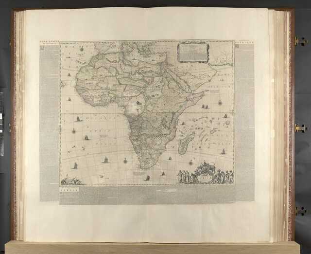
For centuries, the Klencke Atlas remained hidden from public view, its massive pages closed. In April 2010, however, the British Library opened its pages to the public for the first time in 350 years as part of a special exhibition. This event marked a turning point in the atlas’s history, allowing visitors to witness its grandeur firsthand.
The exhibition highlighted the atlas’s role as both a scientific and artistic achievement, drawing attention to its meticulous engravings and historical context. For many, seeing the Klencke Atlas in person was a once-in-a-lifetime opportunity to connect with a piece of 17th-century cartographic history.
Competition for the Title of Largest Atlas
For 350 years, the Klencke Atlas held the distinction of being the world’s largest atlas. This record was finally surpassed in 2012 with the creation of Earth Platinum, an atlas published by Australian cartographer Gordon Cheers. Measuring slightly larger than the Klencke Atlas, Earth Platinum consists of just 31 copies, each priced at $100,000.
While Earth Platinum may hold the title of largest atlas, the Klencke Atlas remains unmatched in historical significance and cultural impact. Its legacy as a pioneering work of cartography continues to endure.
Digitization and Modern Access
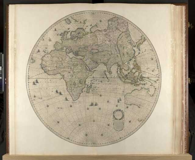
In 2017, the British Library undertook a monumental project to digitize the Klencke Atlas. This effort aimed to preserve the atlas while making it accessible to a global audience. The digitization process involved carefully photographing each map and compiling them into a digital format, ensuring that the atlas could be studied and appreciated without risking physical damage.
Accompanying the digitization was a video documenting the process, offering viewers a behind-the-scenes look at the intricate work involved. This project not only safeguarded the atlas for future generations but also democratized access to one of the world’s most iconic cartographic treasures.
Video:
Conclusion
The Klencke Atlas stands as a symbol of humanity’s quest for knowledge, art, and diplomacy. From its creation in 1660 as a gift to King Charles II to its modern-day preservation in the British Library, the atlas has traversed centuries as a testament to human ingenuity. Its maps, engravings, and historical significance continue to inspire awe, reminding us of the enduring power of cartography to connect people across time and space. As it enters the digital age, the Klencke Atlas remains not just an artifact but a living legacy of exploration and discovery.
