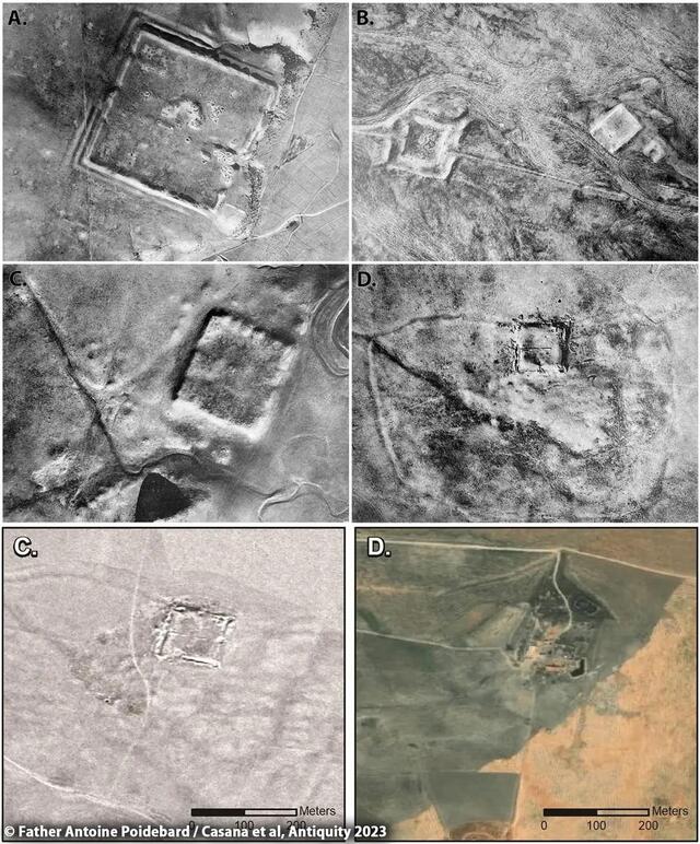
The declassification of Cold War-era satellite imagery has unveiled a groundbreaking discovery: 396 previously unknown Roman forts scattered across Syria and Iraq. This revelation challenges traditional understandings of the Roman Empire’s eastern frontier, transforming our knowledge of ancient networks and the role these structures played in trade and cultural exchange.
Historical Background: From Aerial Surveys to Satellite Images
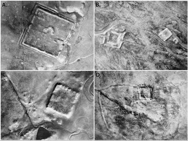
The origins of this research trace back to the 1920s, when French Jesuit priest Father Antoine Poidebard pioneered one of the earliest aerial archaeological surveys. Documenting 116 Roman forts along what he believed to be the empire’s eastern border, Poidebard’s work provided an unprecedented glimpse into Roman frontier architecture. However, his methods were limited by the technology of the time, relying on rudimentary photographic techniques that left many structures undetected.
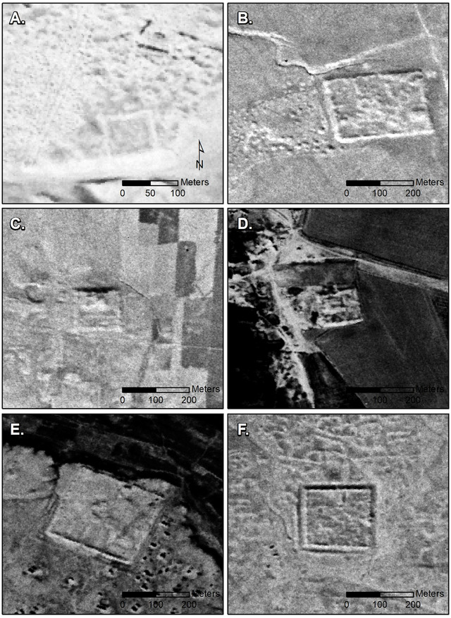
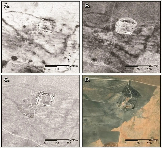
Fast-forward to the 1960s and 70s: The Cold War catalyzed the development of advanced satellite technology, such as the Corona and Hexagon spy programs. Initially designed for military reconnaissance, these satellites captured detailed images of vast regions, including the Middle East. Decades later, the declassification of these images has provided archaeologists with a treasure trove of data. Professor Jesse Casana of Dartmouth College and his team have used this resource to expand on Poidebard’s findings, identifying nearly 400 Roman forts that were previously unrecorded.
The Role of Cold War Satellite Imagery
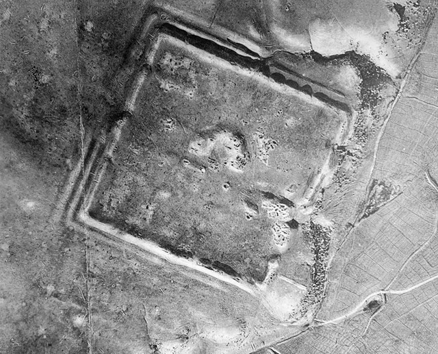
Using high-resolution imagery from the Corona and Hexagon satellites, Casana’s team employed modern analytical techniques to identify structures that had eluded earlier archaeologists. The distinct square-shaped design of Roman forts, typically 50-80 meters per side, helped distinguish these ancient structures from modern buildings. Despite the erosion of their walls, the remains of these forts were clearly visible in the satellite images.
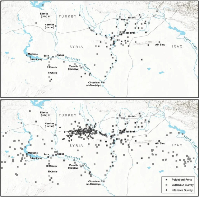
The researchers mapped these sites across the Syrian steppe, revealing a far more extensive network than previously imagined. While Poidebard’s initial survey had focused on the Roman Empire’s supposed eastern boundary, the new findings challenge the idea of a rigid border. Instead, they suggest a fluid, interconnected frontier designed to facilitate trade and cultural exchange rather than serve as a purely defensive barrier.
Redefining Roman Frontiers
For centuries, historians viewed the Roman Empire’s frontiers as fortified borders meant to keep enemies at bay. However, the distribution of these newfound forts tells a different story. Rather than forming a strict line of defense, the forts appear to have been strategically placed to support economic and cultural networks. This interpretation aligns with evidence of Roman trade routes extending deep into the Near East, connecting the empire to distant regions through commerce and diplomacy.
Professor Casana emphasized this point, stating, “Historically, as an archaeologist, I can say that there have been many attempts by ancient states to build walls across borders, and it has been a universal failure.” The forts, rather than isolating the empire, likely served as hubs for interaction and cooperation, reflecting the complexities of Roman frontier management.
Architectural Insights: The Forts’ Distinct Features
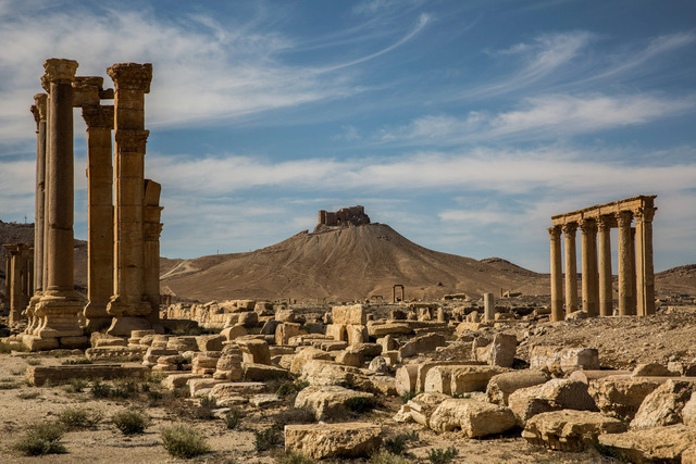
The Roman forts discovered through satellite imagery share several defining characteristics. Their square shapes, with sides measuring between 50 and 80 meters, are a hallmark of Roman military engineering. Despite centuries of erosion, the remnants of these structures remain distinguishable in the imagery, allowing researchers to confirm their identity.
These forts were not isolated outposts. Instead, they were part of a broader network, with some positioned along key trade routes and others in locations conducive to agricultural production. This strategic placement underscores their dual purpose as both military installations and economic hubs, bridging the empire’s needs for security and sustenance.
The Threat of Modern Development
While the discovery of nearly 400 Roman forts is a remarkable achievement, it also highlights a sobering reality: many of these archaeological sites are at risk. Urban expansion and agricultural development have already destroyed several of the identified forts, emphasizing the urgency of documenting and preserving these ancient structures.
Satellite imagery has proven invaluable in this regard. By capturing detailed images of the landscape before modern activities alter it irreparably, researchers can create a lasting record of these historical features. However, the ongoing loss of archaeological sites underscores the need for greater awareness and conservation efforts.
Future Prospects in Archaeology
The success of Casana’s research demonstrates the transformative potential of satellite imagery in archaeology. As more declassified imagery becomes available, including photographs from U2 spy planes, researchers anticipate further discoveries in the Near East and beyond. Advanced technologies, such as artificial intelligence and machine learning, are also poised to play a crucial role in analyzing these vast datasets, enabling archaeologists to identify and interpret features more efficiently.
Professor Casana expressed optimism about the future of satellite-based archaeology, noting, “Careful analysis of these powerful data holds enormous potential for future discoveries.” Beyond the Roman forts, similar methods could uncover previously unknown sites from other civilizations, shedding light on the interconnected histories of ancient societies.
Conclusion
The discovery of nearly 400 Roman forts through Cold War-era satellite imagery marks a significant milestone in archaeological research. By challenging long-held assumptions about the Roman Empire’s eastern frontier, this study underscores the importance of integrating modern technology with traditional methods. As more imagery is analyzed and new techniques are developed, the field of archaeology stands on the brink of even greater revelations, offering fresh perspectives on the ancient world.
